Henri Abraham Chatelain (1684-1743)
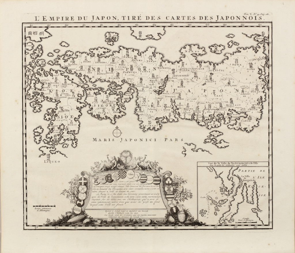
L'EMPIRE DU JAPON, TIRÉ DES CARTES DES JAPONNOIS
From: Atlas Historique, vol. 5, Amsterdam, 1719
Copperplate engraving, H. 36 x W. 43.5 cm
Chatelain's historical altas included Adrien Reland's 1715 map. Chatelain proudly calls attention to the map's Japanese model, but he says nothing of its true origin. Chatelain's historical atlas was one of the encyclopedic works of the French Enlightment, published in large editions and widely distributed.
Maps of Japan
After Italy and Antwerp, Amsterdam emerged as the most important center ofg map making in the early 17th century. However, initially the most important cartographers all worked for the VOC, the Dutch East India Company, established in 1602, and were bound by secrecy. That way the VOC ensured that material gathered by pilots sailing on her ships could only deliver their findings to the VOC headquarters where cartographers could work on this sensitive material. By the end of the 17th century this rule of secrecy was relaxed, 'secret' material became accessible and the manuscript chart models used by the company were gradually put into print.
From: Atlas Historique, vol. 5, Amsterdam, 1719
Copperplate engraving, H. 36 x W. 43.5 cm
Chatelain's historical altas included Adrien Reland's 1715 map. Chatelain proudly calls attention to the map's Japanese model, but he says nothing of its true origin. Chatelain's historical atlas was one of the encyclopedic works of the French Enlightment, published in large editions and widely distributed.
Maps of Japan
After Italy and Antwerp, Amsterdam emerged as the most important center ofg map making in the early 17th century. However, initially the most important cartographers all worked for the VOC, the Dutch East India Company, established in 1602, and were bound by secrecy. That way the VOC ensured that material gathered by pilots sailing on her ships could only deliver their findings to the VOC headquarters where cartographers could work on this sensitive material. By the end of the 17th century this rule of secrecy was relaxed, 'secret' material became accessible and the manuscript chart models used by the company were gradually put into print.
Part of the Indonesian Archipelago collection.