Nicolas de Fer (Paris 1647-1720)
NICOLAS DE FER (PARIS 1647-1720)
\109.5 x 163 cm\
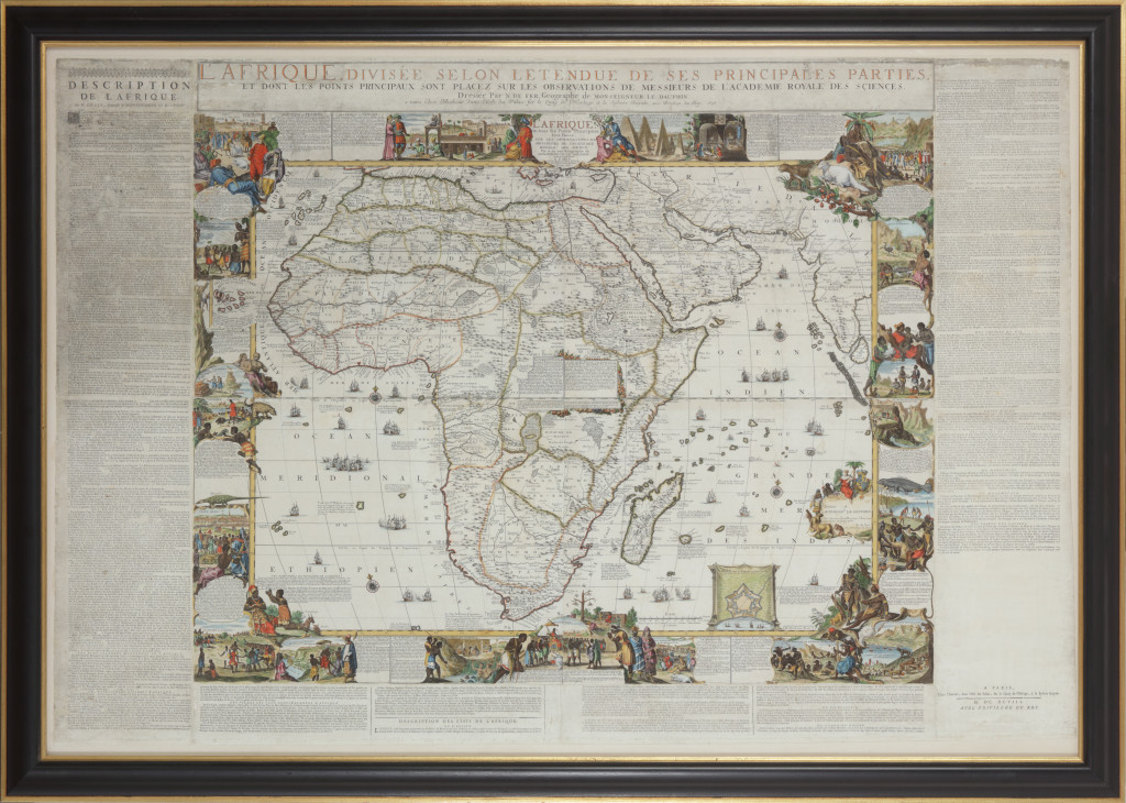
L’Afrique divisée selon letendu de ses principales parties, et dont les points principaux sont placez sur les observations des Messieurs de l’Academie Royale des Sciences. Dressée par N. De Fer, Geographe de monsieur de Dauphin. A Paris chez l’auteur dans l’Isle du Palais, fur le Quay de l’Horloge, à la Sphere Royal. Avec le Privilege du Roy, 1698
Description de l’Afrique par N. de Fer (in relief printing). Engraved by Hendrik van Loon after design by Nicolaas de Fer. Printed on four copperplates and surrounded by texts in relief printing, later hand colouring.
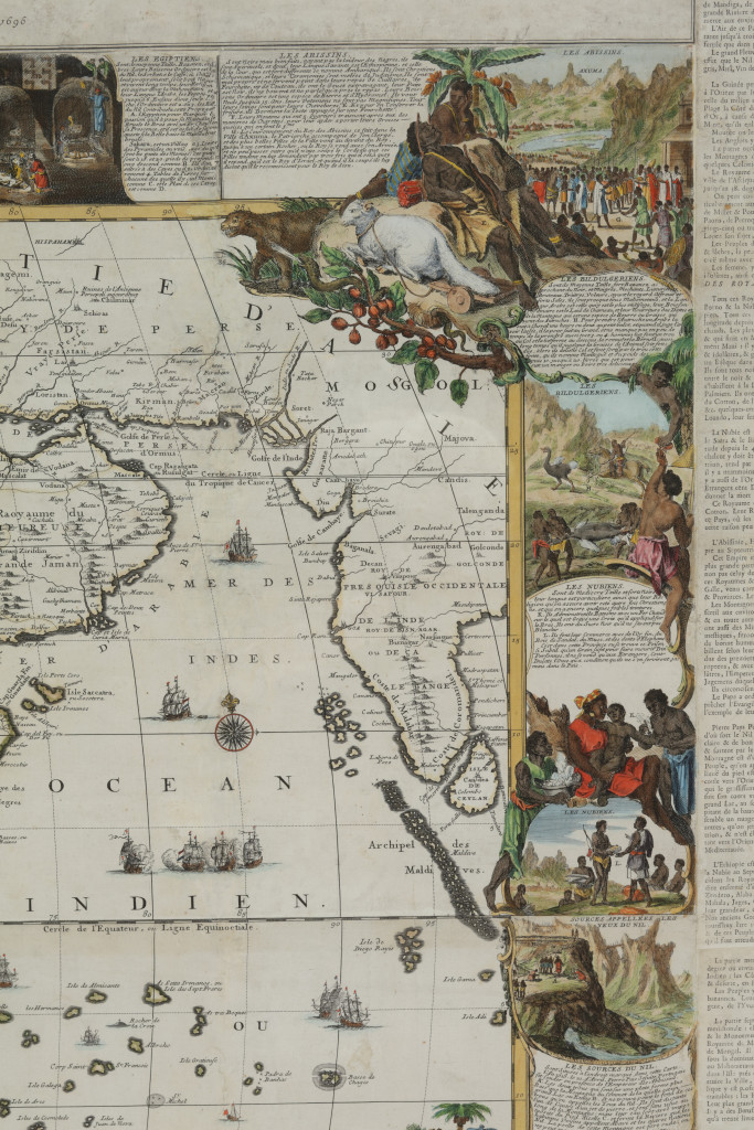
The map is surrounded by richly decorated borders, depicting the peoples of Africa, the Moroccans, inhabitants of Fez, Algerians and inhabitants of Tripoli, Egyptians, Abyssinians, Bildulguriens(?), Nubians, inhabitants of Sénegal, lower Ethiopia (South Africa), Madagascar, Congo, Luongo, Benin, Guinée, Canary and Cape Verde islands. A small insert map shows the Dutch fort at Cape of Good Hope. In the surrounding text information, known in the late 17th century, is given on the geography of Africa, its rivers, lakes, islands, capes, mountains, towns, kingdoms, peoples, the Sahara desert and the source of the river Nile.
\109.5 x 163 cm\
L’Afrique divisée selon letendu de ses principales parties, et dont les points principaux sont placez sur les observations des Messieurs de l’Academie Royale des Sciences. Dressée par N. De Fer, Geographe de monsieur de Dauphin. A Paris chez l’auteur dans l’Isle du Palais, fur le Quay de l’Horloge, à la Sphere Royal. Avec le Privilege du Roy, 1698
Description de l’Afrique par N. de Fer (in relief printing). Engraved by Hendrik van Loon after design by Nicolaas de Fer. Printed on four copperplates and surrounded by texts in relief printing, later hand colouring.
The map is surrounded by richly decorated borders, depicting the peoples of Africa, the Moroccans, inhabitants of Fez, Algerians and inhabitants of Tripoli, Egyptians, Abyssinians, Bildulguriens(?), Nubians, inhabitants of Sénegal, lower Ethiopia (South Africa), Madagascar, Congo, Luongo, Benin, Guinée, Canary and Cape Verde islands. A small insert map shows the Dutch fort at Cape of Good Hope. In the surrounding text information, known in the late 17th century, is given on the geography of Africa, its rivers, lakes, islands, capes, mountains, towns, kingdoms, peoples, the Sahara desert and the source of the river Nile.
Part of the Africa collection.
Related objects
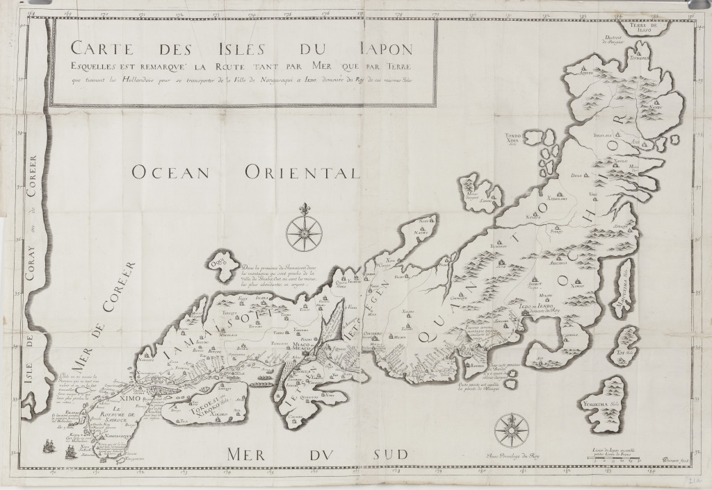
Carte des Isles du Japon, esquelles est remarqué, la Route tant par Mer que par Terre que tiennient les Hollandios pour se transporter de la Ville de Nangasaqui a I'edo demeure du Roy de ses marmes isles Paris 1679, by Jean-Baptiste Tavernier (1605-1689)
From “Recüeil des plusieurs. Relations et Traitez singuliers et curieux de J.B.Tavernier”
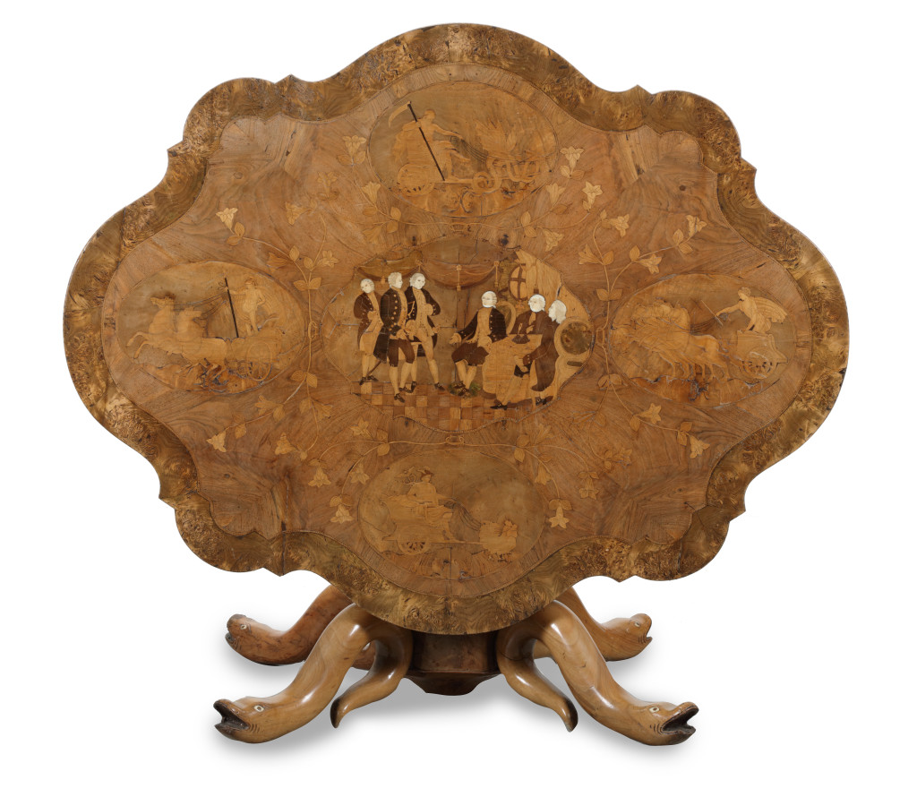
A very interesting centre table commemorating the Paris Treaty between the original thirteen states of the United States of America and Great Britain ending the American Revolution or War of Independence in 1783
France, or possibly the United States of America, 1886, signed and dated, Camurri Enrico Fece l’anno ‘86